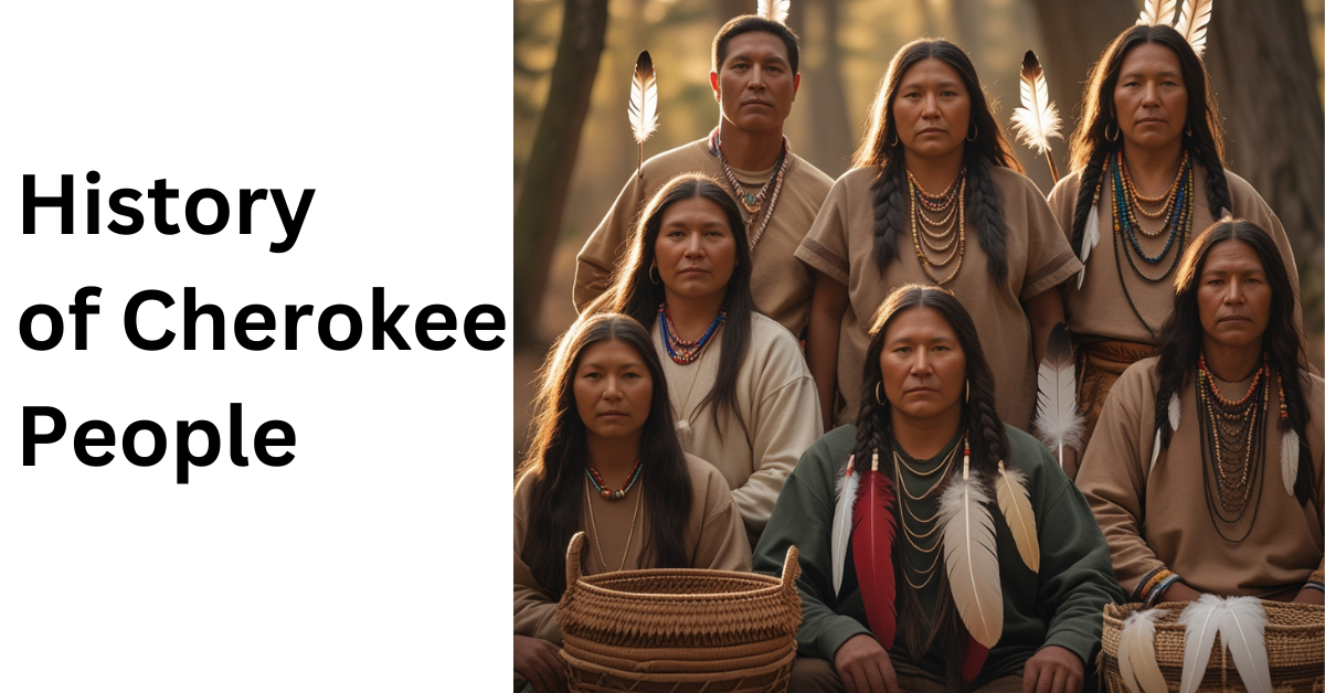
Cherokee: An Overview
The Cherokee, a Native American people of Iroquoian lineage, were among the largest and most politically integrated tribes during European colonization. Their name, derived from a Muscogee word meaning “people of different speech,” is often replaced by their preferred names: Keetoowah or Tsalagi. Around 1650, their population was estimated at 22,500, with control over approximately 40,000 square miles of the Appalachian region, covering parts of present-day Georgia, Tennessee, North Carolina, and South Carolina.
Early Life and Culture
Cherokee society mirrored other Southeastern tribes, organized into a confederacy of “red” (war) and “white” (peace) towns. Towns featured council houses for meetings and religious ceremonies, such as the Green Corn festival. Cherokee homes were bark-roofed log cabins, and their economy combined agriculture (corn, beans, squash) with hunting (deer, bear, elk).
European Contact and Alliances
Spanish explorers first encountered the Cherokee in the 16th century. By the 18th century, they allied with the British, participating in the French and Indian War (1754–63). British policies eventually destabilized Cherokee economies, leading to significant land cessions like the 1773 Treaty of Augusta.
The American Revolution
During the Revolutionary War, the Cherokee supported the British, hoping they would enforce territorial boundaries. After initial raids against colonial forts in 1776, they faced devastating retaliatory campaigns that destroyed their villages. Subsequent treaties, like those at DeWitt’s Corner (1777) and Long Island of Holston (1777, 1781), forced further land losses.
Adaptation and Assimilation
Post-1800, the Cherokee adopted aspects of settler culture, forming a U.S.-style government, engaging in farming, and even adopting a written language. Sequoyah’s 1821 syllabary enabled widespread literacy. They established the Cherokee Phoenix, the first Native American newspaper, in 1828.
Trail of Tears
Despite assimilation efforts, the discovery of gold on Cherokee land in Georgia intensified pressure for their removal. The Treaty of New Echota (1835) ceded Cherokee lands east of the Mississippi for $5 million. In 1838–39, 16,000 Cherokee were forcibly relocated to Oklahoma during the Trail of Tears, where harsh conditions and poor planning resulted in the deaths of about 4,000 individuals.
Life in Oklahoma
In Indian Territory (modern-day Oklahoma), the Cherokee joined other relocated tribes. Despite internal feuds, they maintained a quasi-autonomous government until 1906. In preparation for Oklahoma statehood (1907), communal lands were allocated to individuals, with remaining land opened to settlers.
Modern Era
Some Cherokee evaded removal and remained in North Carolina, forming the basis of today’s Eastern Band of Cherokee Indians. By the early 21st century, more than one million individuals identified as Cherokee, with 225,000 claiming sole Cherokee descent.
Broader Native American Context
Native Americans, encompassing diverse tribes across the Americas, utilized tools like fire drills, stone implements, and domesticated crops (corn, beans, squash). Societies ranged from small bands to large cities like Cahokia, with populations up to 20,000. European colonization led to devastating losses from disease, conquest, and enslavement. Despite these challenges, Native peoples have made strides in regaining autonomy and preserving their cultural heritage.
Regional Highlights
- Arctic: Inuit and Yupik relied on hunting and fishing, living in dome-shaped houses.
- Subarctic: Groups like the Cree and Ojibwe lived in small bands, utilizing snowshoes and toboggans.
- Northeast: Tribes like the Iroquois and Algonquin cultivated crops and formed political alliances such as the Iroquois Confederacy.
The Southeast
The Southeast region extends from the southern edge of the Northeast culture area to the Gulf of Mexico, and from the Atlantic Ocean to west of the Mississippi Valley. Its climate ranges from warm temperate in the north to subtropical in the south. This region’s landscape includes coastal plains, rolling uplands known as the Piedmont, and parts of the Appalachian Mountains, with the Piedmont being the most densely populated area. Key ecosystems include coastal scrub, wetlands, and deciduous forests.
The Cherokee, Choctaw, Chickasaw, Muscogee, and Seminole—collectively referred to as the Five Civilized Tribes—are among the most recognized Indigenous peoples from this area. Other prominent groups include the Natchez, Caddo, Apalachee, Timucua, and Guale. Most tribes in the Southeast traditionally spoke Muskogean languages, alongside some Siouan speakers and the Iroquoian-speaking Cherokee.
The region’s economy was largely agricultural, fostering social stratification within chiefdoms structured around hereditary elites and commoners. People lived in hamlets along waterways, each home to extended families and comprising houses, granaries, and summer kitchens. These hamlets surrounded towns, which served as ceremonial and market hubs, often featuring large earthen mounds supporting religious or ruling-class structures. Towns and their hamlets formed autonomous political entities but could unite into confederacies like the Muscogee and Choctaw during times of need.
Agriculture focused on crops like corn, beans, squash, and tobacco, supplemented by gathering wild plants, hunting, and fishing. Housing styles varied, including wickiups, earth-berm dwellings, and chickees. Religious practices featured bird-themed iconography and rituals involving the “black drink,” an emetic used ceremonially.
The Plains
The Plains span the central continent, between the Rocky Mountains and the Mississippi River Valley, and from the Subarctic’s southern edge to the Rio Grande in Texas. West of the Missouri River, short-grass prairies with low rainfall predominate, while rolling tallgrass prairies with more moisture dominate to the east. Tree-lined river valleys act as natural oases.
Plains tribes spoke a variety of languages, including Siouan, Algonquian, Uto-Aztecan, and others, and developed a sign language for intertribal communication. Settlements initially consisted of earth-lodge villages along major waterways, where fertile soils supported agriculture. Groups like the Mandan, Hidatsa, Omaha, Pawnee, and Arikara cultivated crops and engaged in seasonal hunting expeditions.
By 1750, the arrival of Spanish horses revolutionized bison hunting, drawing some villagers into nomadic lifestyles, such as the Apsáalooke. Other tribes, including the Oceti Sakowin, Blackfoot, Cheyenne, Comanche, Arapaho, and Kiowa, adopted this lifestyle. Common cultural elements included tepees, tailored leather clothing, and ceremonial items like feathered headdresses and large drums. Rituals such as the Sun Dance were central to Plains spiritual life.
The Southwest
The Southwest encompasses areas between the Rocky Mountains and Mexico’s Sierra Madre, mainly in Arizona and New Mexico. Its arid climate includes temperate plateaus and semitropical basins, with ecosystems dominated by deserts. Major rivers like the Colorado and Rio Grande provide essential water sources.
This region’s languages include Hokan, Uto-Aztecan, Tanoan, and Athabaskan, among others. Agriculture and foraging were common, with Pueblo peoples like the Zuni and Hopi excelling in farming and constructing adobe and stone apartment houses. The Navajo and Apache combined agriculture with hunting and raiding, while the Yumans, Pima, and Tohono O’odham adapted flexibly to environmental conditions.
Major crops included corn, beans, squash, and cotton, with foraged foods supplementing diets. Pueblo communities were known for their intricate kinship systems, kachina dances, and artistry in pottery, textiles, and sand paintings. The Navajo built round hogans, while other groups used thatched or brush shelters. Common technologies included stone channels and basketry, essential for managing scarce water resources.
The Great Basin
The Great Basin, centered in Nevada, spans parts of California, Oregon, Idaho, and other states. The region’s basin-and-range topography creates a bowl-like landscape with brackish lakes and arid deserts. Despite the harsh climate, higher elevations provide some moisture, while the predominant ecosystem is desert.
Inhabitants included the Washoe and various Numic-speaking tribes like the Paiute, Shoshone, and Ute. These groups were hunters and gatherers, organizing in kin-based mobile bands. Seeds, piñon nuts, and small game formed the diet, while horses enabled some tribes to hunt bison and adopt Plains-style tepees. Traditional tools included digging sticks, nets, and grinding stones, while cultural expression often took the form of rock art.
California
California’s diverse topography ranges from coastal redwood forests to high deserts and mountains. This area’s linguistic diversity, encompassing over 20 language families, is unparalleled in North America. Prominent tribes include the Hupa, Yurok, Pomo, Maidu, and Yana.
Tribes in California typically organized into small, politically independent tribelets, with larger groups forming in resource-rich areas. Agriculture was rare, except along the Colorado River, with most relying on hunting, fishing, and gathering, particularly acorns, which were processed into a stable food source. Housing ranged from single-family dwellings to communal buildings, and ceremonial structures often accommodated large gatherings. California tribes were renowned for their basketry, trade fairs, and spiritual traditions like the Kuksu religion.
The Northwest Coast
The Northwest Coast stretches from Yakutat Bay in Alaska to the Klamath River in California, bordered by steep coastal mountains. The region’s abundant precipitation supports ecosystems like temperate rainforests and intertidal zones.
Peoples like the Tlingit, Haida, and Coast Salish utilized the region’s rich resources, relying on salmon, sea mammals, and wild plants. Unique among nonagricultural societies, they developed highly stratified societies with hereditary elites, commoners, and enslaved individuals. Social organization centered around “houses,” which combined extended families and resource rights.
Villages, often near waterways, featured large timber-plank dwellings. The Northwest Coast is celebrated for its totem poles, intricate carvings, and potlatch ceremonies, where gifts symbolized wealth and social status.
The Plateau
The Plateau region is uniquely situated at the intersection of five distinct cultural areas: the Subarctic, Plains, Great Basin, California, and Northwest Coast. Surrounded by mountains and traversed by the Fraser and Columbia river systems, this area includes parts of modern-day Montana, Idaho, Oregon, Washington, and British Columbia. The topography is marked by rolling hills, high flatlands, deep gorges, and mountain slopes. The temperate climate is moderated by surrounding mountain ranges, which shield the area from continental air masses. However, these same mountains create a rain shadow effect, leading to drier conditions in lower elevations. Grasslands and high desert predominate, though higher altitudes feature significant forested areas.
Linguistically, the Plateau is home to languages from the Salishan, Sahaptin, Kutenai, and Modoc-Klamath families. Tribes inhabiting this region include the Salish, Nimiipuu, Yakama, Kootenai, Modoc and Klamath, Spokan, Kalispel, Pend d’Oreille, Coeur d’Alene, Walla Walla, and Umatilla. Villages served as the primary political units, though some groups established larger tribal governments, chieftainships, and inter-tribal confederations, facilitated by the abundant salmon and other resources of the Columbia and Fraser rivers. Despite this, the region’s population density and social stratification were lower than that of the Northwest Coast.
Plateau peoples were skilled hunters and gatherers. While fish, especially salmon, formed a dietary staple, terrestrial animals and wild plants, including camas (Camassia), supplemented their diet. Permanent riverside villages were common, with upland areas used seasonally for foraging. The introduction of horses led some groups to adopt nomadic buffalo hunting, incorporating Plains cultural practices like the use of tepees. Plateau villages featured multifamily A-frame dwellings covered with grass, with conical structures used during upland expeditions. Over time, canvas became a preferred covering material. Exposure to extensive trade networks enabled the Plateau peoples to adopt and adapt various technologies, showcasing their material ingenuity.
Prehistory
Indigenous Americans maintain rich oral traditions about their origins. However, until the late 19th century, many outsiders’ beliefs about Native American history were speculative and often steeped in misconceptions. Myths suggested connections to the Ten Lost Tribes of Israel, Atlantis, or a separate “Mound Builder” civilization. Such ideas, used to justify the displacement of Indigenous peoples, were debunked in the 1890s when Cyrus Thomas, a Smithsonian Institution archaeologist, confirmed that Native Americans were the creators of the effigy, burial, and temple mounds of the Northeast and Southeast.
The prevailing theory until the late 1980s held that humans arrived in the Americas around 13,500 years ago, as evidenced by Clovis projectile points found in New Mexico. During the last ice age, a landmass known as Beringia connected Asia and North America via the present-day Bering Strait. This land bridge emerged 36,000–40,000 years ago as glaciers absorbed water, lowering sea levels by up to 400 feet. Beringia remained viable between 28,000 and 10,000 BCE, spanning up to 1,000 miles north to south.
Early inhabitants of Beringia were hunter-gatherers traveling in small, kin-based bands. While glaciers initially blocked access to North America, some Beringians likely followed coastal routes southward, potentially using boats. Others might have traversed ice-free corridors in the interior, although these pathways were inaccessible until about 12,600 years ago. Archaeological sites like Gault (Texas), Monte Verde (Chile), and Meadowcroft Rockshelter (Pennsylvania) indicate human presence in the Americas as early as 18,000 years ago, suggesting coastal migrations occurred before interior routes were viable.
Paleo-Indian Cultures
The earliest cultures in North America are collectively termed Paleo-Indians. By 6000 BCE, some groups had begun experimenting with agriculture alongside foraging, transitioning into Archaic cultures. Paleo-Indians lived alongside Pleistocene megafauna such as mammoths and giant bison. While early archaeological methods emphasized large game hunting, sites like Gault and Jake Bluff revealed a more diverse diet, including small mammals, fish, and plants, indicating a broader subsistence strategy.
The Clovis and Folsom cultures represent two prominent Paleo-Indian traditions. Clovis points, dated to 9050–8800 BCE, are thin, lanceolate stone tools with fluted bases. Often found at mammoth kill sites, they were accompanied by scrapers and other tools for processing meat. Folsom points, which appeared around 9000 BCE, were more finely crafted, with larger flutes. Sites like Lindenmeier in Colorado demonstrate the sophistication of Folsom toolkits, including engravers and bone artifacts. Related cultures persisted until approximately 4000 BCE.
Transition to Archaic Cultures
Around 6000 BCE, a warming and drying climate led to cultural shifts. Bands became larger and semi-sedentary, foraging from seasonal camps. Archaeological evidence of controlled burns and seed gathering suggests early plant management practices. By 3000 BCE, Northern Americans had domesticated crops like squash, sunflowers, and goosefoot. These developments marked the gradual transition from Archaic to agricultural societies, characterized by pottery and reliance on domesticated foods. While the timeline varied regionally, some Archaic lifeways persisted into the 19th century, particularly in areas like the Pacific Coast and Great Basin.
Prehistoric Farmers
Transition to Agriculture in North America
Around 1000 BCE, many parts of North America witnessed a shift from generalized foraging and horticultural experimentation to a more agriculture-dependent lifestyle, although the timing varied regionally. Corn (maize), first cultivated in Mexico as early as 5000 BCE, reached the Southwest culture area around 1200 BCE and the Eastern Woodlands by about 100 BCE. Other Mesoamerican domesticates, like chili peppers and cotton, appeared in these regions closer to the beginning of the Common Era.
Despite the growing importance of foreign domesticates, many Indigenous groups continued to use locally domesticated plants for centuries. For example, sumpweed was cultivated until about 1500 CE before reverting to its wild state, possibly due to its association with hay fever and contact dermatitis or the cultural disruptions caused by early European conquest. Conversely, domesticates like sunflowers, squashes, beans, and tobacco remain economically important crops into the 21st century.
Characteristics of Prehistoric Farming Communities
Prehistoric farming communities across North America displayed regional and temporal variations but shared common traits. They were generally more sedentary than their foraging predecessors, although the scarcity of domesticated animals (with turkeys and dogs being notable exceptions) necessitated continued hunting. Housing and settlements were more substantial, often fortified with walls or ditches. These communities frequently developed hierarchical social structures, with priestly or chiefly classes exerting authority over commoners.
Southwestern Cultures: Ancestral Pueblo, Mogollon, and Hohokam
Agricultural Innovations
From the early Common Era, three major farming cultures emerged in the Southwest, all utilizing irrigation to some extent:
Ancestral Pueblo (c. 100–1600 CE): Inhabiting the Four Corners region, they used check dams to manage water flow for their fields.
Mogollon (c. 200–1450): Located in the mountainous areas of southwestern New Mexico and southeastern Arizona, they relied on rainfall and stream diversion.
Hohokam (c. 200–1400): Residing in the desert Gila basin of southern Arizona, they constructed extensive irrigation canals.
Cultural Achievements
From approximately 700 to 1300, these cultures experienced significant growth and architectural innovation, coinciding with favorable climatic conditions across the Southwest. This period also saw increased trade and cultural influence from Mesoamerica, bringing items like copper bells, parrots, ball courts, shell trumpets, and intricately designed pottery.
Ancestral Pueblo Developments
Between 1150 and 1300 (Pueblo III period), the Ancestral Pueblo built impressive cliff dwellings, such as those at Mesa Verde, and large, multi-room “great houses” in Chaco Canyon. These structures often used dressed stones and featured stepped terraces, small windows, and roof entries. Kivas, or subterranean ceremonial structures, became prominent, with some exceeding 80 feet in diameter. Pottery and textile craftsmanship flourished, incorporating innovative designs and materials like cotton and yucca fibers.
After 1300, increasing aridity and the arrival of hostile outsiders spurred significant cultural shifts. Rituals emphasizing rain became more elaborate, as depicted in wall paintings and pottery. Communities migrated southward and eastward, establishing new villages along major rivers such as the Rio Grande and Pecos.
Mogollon and Hohokam Contributions
The Mogollon culture peaked during the Classic Mimbres Period (c. 1000–1150), known for its artistic pottery. Following climatic deterioration after 1200, the Mogollon abandoned their territories. The Hohokam expanded their agriculture through extensive irrigation, constructing compact settlements with multi-room buildings. By 1350, Hohokam culture showed influences from both the Ancestral Pueblo and Mesoamerican traditions.
Legacy
The Ancestral Pueblo are ancestors of modern Pueblo peoples, such as the Hopi, Zuni, and Acoma. The Hohokam are linked to the Pima and Tohono O’odham, while the Mogollon likely integrated with other groups after abandoning their villages.
Native American History
Indigenous Perspectives and Documentation
The perspectives of Indigenous peoples from the 15th to 19th centuries are scarce in written form. Historians supplement these gaps with insights from traditional arts, folklore, archaeology, and other sources. The diversity of Native American cultures adds complexity to historical interpretations. For instance, the Natchez, living in stratified societies, interacted differently with Europeans than did the Apache, who relied on hunting and gathering.
Population Estimates and Impact of Epidemics
Estimates of pre-Columbian population north of the Rio Grande vary widely, from 900,000 to 18 million individuals. Early scholars like James Mooney and A.L. Kroeber suggested lower figures, while later researchers like Henry Dobyns proposed higher numbers, considering the catastrophic impact of epidemics introduced by Europeans. Diseases such as smallpox, combined with famine and displacement, caused mortality rates as high as 95% in some cases. Pre-Columbian epidemics may have begun as early as the 10th century during Norse contact with North America.
Resilience Amid Conquest
While acknowledging the devastating effects of conquest, historians also emphasize the resilience of Indigenous peoples. Native American communities adapted and persevered despite severe population losses, battles, and cultural disruptions.
Ethnic and Political Diversity
Determining the number of ethnic and political groups in pre-Columbian North America is challenging. Language diversity was immense, with over 50 language families and 300–500 languages compared to Europe’s two language families. Political organization often relied on consensus-based systems, except in hierarchical societies like those in the Southeast and Northwest Coast.
This extraordinary linguistic and political diversity highlights the rich and complex cultural landscape of Indigenous North America, which far exceeded that of contemporary Europe.